lanestyle
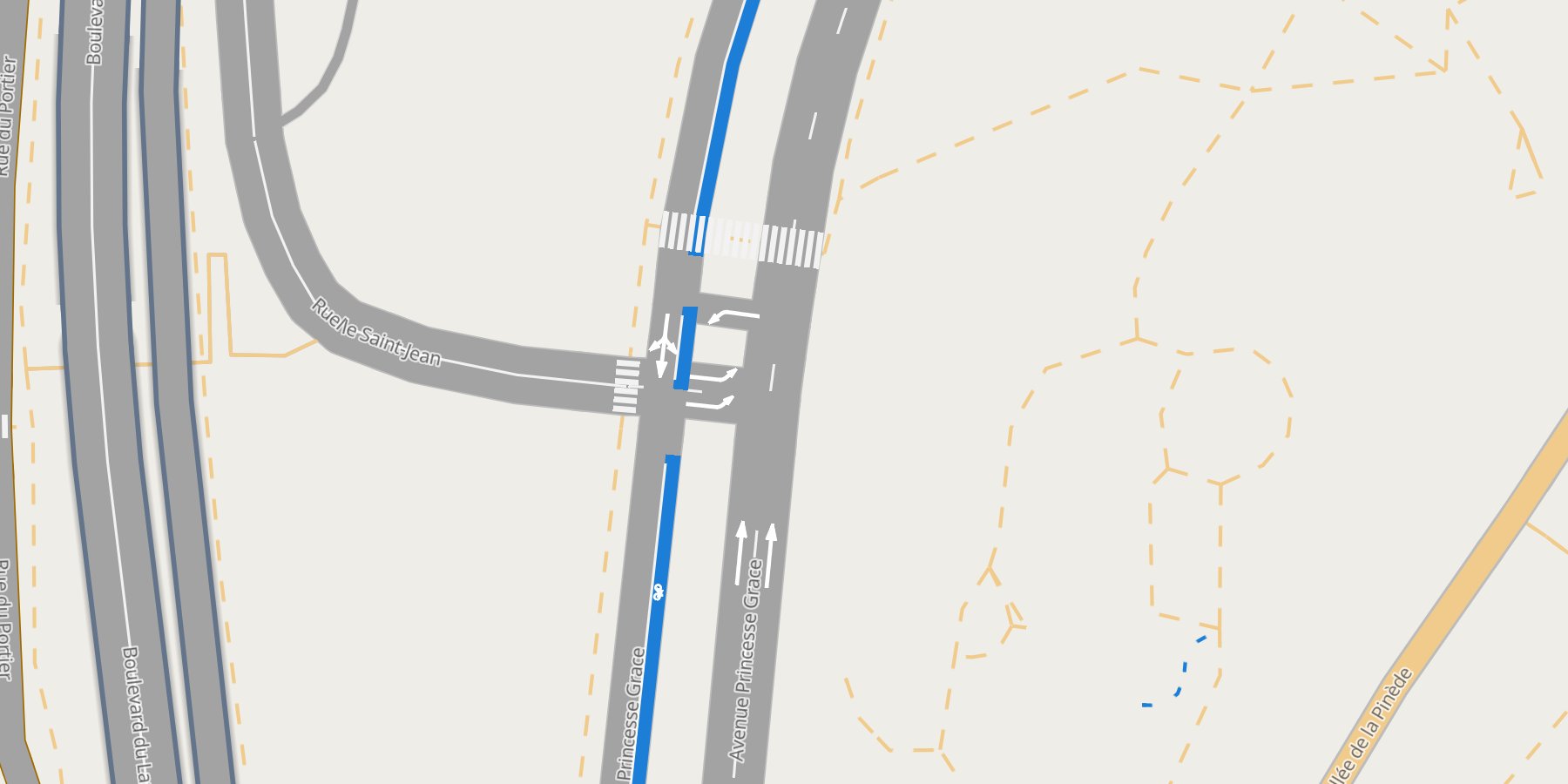
Lane-level road maps for Python: every road as wide as its lanes, with its bus and bike lanes, lane lines, turn arrows, zebra crossings and sidewalks. One offline HTML page.
import lanestyle as ls

ls.lane_page("monaco.levels", "monaco_gmns.duckdb", "monaco.duckdb").save("lanes.html")
lanestyle draws nothing of its own. roadstyle draws every road: one line as wide as its lanes, with its outline, bridges over and tunnels under, street names, hover and click, exactly as roadstyle's level editor draws it. lanestyle reads the lanes that duckOSM exports (GMNS, with the turns from SUMO) and puts them on those roads, so a road you fix in the editor is fixed on the page too.
What you can do
-
Map an area
Three duckOSM commands and one call, from an OpenStreetMap extract to the page.
-
Lanes and markings
Bus and bike lanes, dashed and solid lane lines, turn arrows, BUS and bike marks, in metres.
-
Junctions, zebras, sidewalks
Lanes stop where a junction begins; painted crossings and tagged sidewalks, nothing guessed.
-
Fix the drawing
Which road is over which, and how its ends look: roadstyle's level editor, with your lanes on it.
-
Settings
Colours, widths, dashes, marks: one
lanestyle.json. -
See it live
Monaco, lane by lane, full screen in your browser.
The family
| draws | from | |
|---|---|---|
| roadstyle | a road network, one line per edge | any edges GeoDataFrame |
| mapstyle | a whole base map with the roads | a duckOSM database |
| lanestyle | the lanes and markings on every road | a duckOSM database, its GMNS lanes and level area |
All three save one HTML page that works offline and speaks the same rs* JavaScript API.