Style the roads
Pick a palette and a base map, switch the map's controls on or off, show bridges in 3D, and keep only the road classes you want.
Palettes
A palette sets each road class's colour, width and casing.
highsat: bright, high contrast. The default.carto: the muted colours of the OpenStreetMap standard map.mono: shades of grey. Use it under your own data colours.
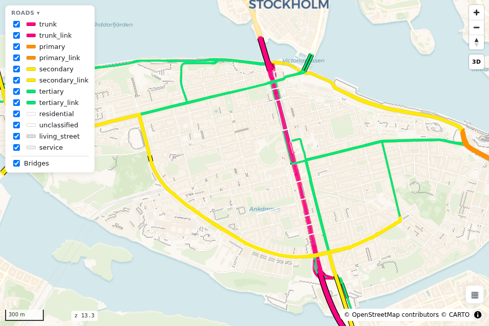
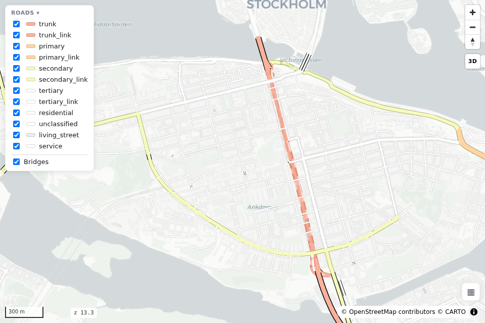
To change a class's colour or add a palette, see Settings & palettes.
Base maps
basemap= sets the background, basemaps= sets the list in the base-map switcher (bottom-right).
rs.render_edges(edges, basemap="dark_matter", basemaps=["dark_matter", "positron", "satellite"])
rs.render_edges(edges, palette="mono", basemap="blank")      # no tiles: works offline
voyager(the default),positron,dark_matter: CARTO.osm,esri_gray,esri_street,esri_dark_gray: no key needed.satellite: Esri World Imagery.blank,blank_dark: a plain canvas with no network requests, so the file works offline.
CARTO needs a free key
Without one, CARTO tiles show an "API KEY REQUIRED" watermark. Set a key or use a keyless base map: Base maps & API keys.
Map controls
Labels, one-way arrows, the road-class filter panel and the base-map switcher are all on by default. Turn any of them off:
On the command line: --no-labels, --no-arrows, --no-filter, --no-basemap-switcher.
3D bridges
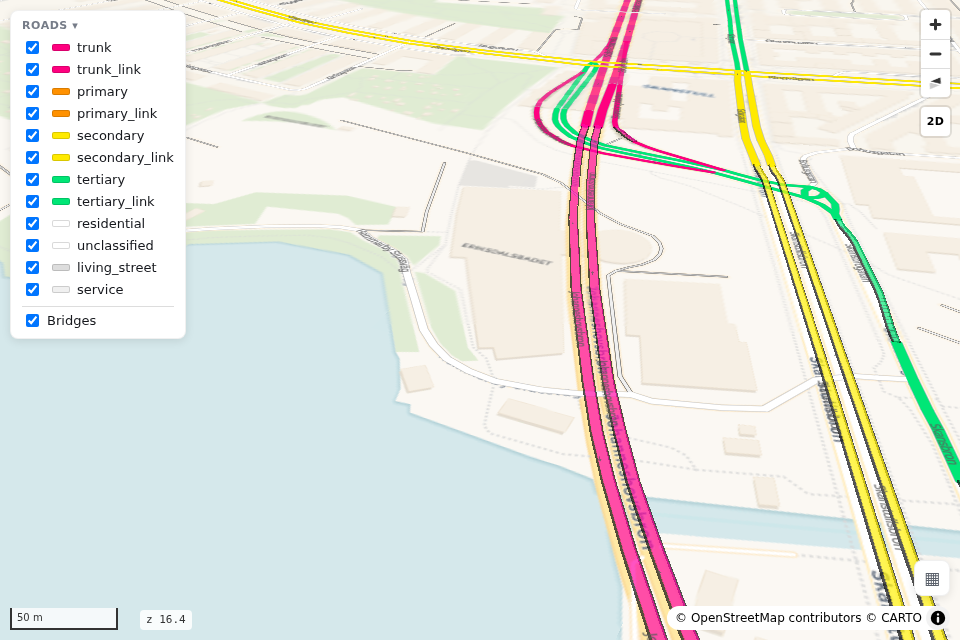
view_3d=True tilts the camera and draws bridges as raised decks, so you can see the roads that
pass under them. Every map also has a 2D/3D button. Below zoom 16 bridges draw flat.
Keep or drop road classes
rs.highway_types(edges)                                      # the classes in your data
rs.render_edges(edges, include=["motorway", "trunk", "primary", "secondary"])
rs.render_edges(edges, exclude=["service", "footway", "path", "cycleway"])
rs.render_edges(edges, minzoom=True)                         # hide minor classes when zoomed out
include and exclude also keep or drop the *_link ramps of each class (match_links=True).
minzoom can also be a dict such as {"residential": 14} to change the zoom for some classes.
Your own road classes
For a class column that is not OSM highway (say NVDB functional classes), register a palette of
RoadStyle(fill, width, casing_width) per class and style by that column:
from roadstyle import RoadStyle, color_by_class, register_palette

register_palette("nvdb", {"0": RoadStyle("#00E5FF", 6, 8), "1": RoadStyle("#FF9100", 4.5, 6.5)})
rs.render_edges(edges, style=color_by_class("functional_road_class", palette="nvdb",
                                            normalize_links=False))
save_palette / load_palette keep it as JSON (Settings & palettes).
See also: Every parameter · Settings & palettes · Gallery · JavaScript API (rsSetBasemap, rsSetClasses, rsSetView3D)